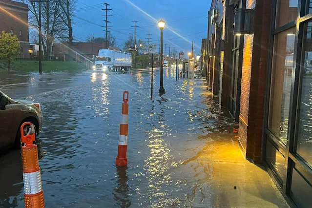
A probable tornado caused damage to mobile homes and uprooted trees in Kentucky, while buildings were also damaged in Tennessee as severe weather swept across several states on Tuesday, officials reported.
No fatalities have been reported in what the National Weather Service described as a major spring storm, but officials in Kentucky reported collisions resulting in injuries. Governor Andy Beshear declared a state of emergency, stating, "We have reports of substantial damage to a number of structures, and thankfully, as of right now, we are not aware of any fatalities."
Tornado watches covered more than 16 million people on Tuesday evening from northeastern Louisiana to central Ohio, while flash flood watches covered an area from West Virginia and Pennsylvania to New York. In Kentucky, photos from the Boyd County Emergency Management office indicated "tornadic damage of at least EF1 intensity," with two mobile homes displaced or rolled.
In Sunbright, Tennessee, Billy Glen Kennedy received a call informing him that his funeral home had been destroyed. Kennedy, the owner of the heavily damaged Schubert Funeral Home, said, "I had no idea I’d come up here and find this."
Multiple rounds of storms were forecast for the Ohio Valley, middle Tennessee, and the Southeast on Tuesday. Parts of Kentucky were under a tornado watch until 10 p.m., with Beshear urging residents to remain prepared.
Mayor Linda Gorton of Lexington, Kentucky, reported one weather-related injury, with the Lexington Fire Department receiving 61 calls for emergency service, two calls for trees crashing into homes, and two structure fires caused by downed power lines. Three injury collisions and seven collisions without injuries were also reported.
Beshear confirmed an EF1 tornado in Nelson County and another EF1 tornado in Anderson County, with gusts between 86 and 110 mph on the Enhanced Fujita Scale.
Tuesday's possible tornadoes followed severe weather that affected parts of the Midwest on Monday, including severe thunderstorm watches in parts of Indiana and Ohio.
Flooding was reported in Columbus, Ohio, and a travel advisory was in place in New York City for Wednesday, with additional rain expected.
Late-season heavy snow and gusty winds were expected across the Great Lakes and the Northeast through midweek.
Most of Wisconsin was under a winter storm warning or winter weather advisory on Tuesday, with snowfall rates in some areas reaching 1 inch per hour.
At least four tornadoes were reported on Monday in Oklahoma and Missouri, causing damage to several homes in Barnsdall, Oklahoma. Public schools were closed in Barnsdall on Tuesday due to the weather.
Between 2 and 3 additional inches of rain fell in the Pittsburgh area on Tuesday, exacerbating flooding concerns across the region.
The Weather Prediction Center issued flood watches for areas from Indiana to New Jersey, with the potential for flash flooding in urban areas, roads, and small streams.
On Wednesday, the mid-Atlantic and Florida were under a severe weather risk, with the possibility of heavy, wet snow and sleet in the Northeast.
Significant snow accumulations were expected in upstate New York and northern New England, potentially leading to hazardous travel conditions.
The Weather Prediction Center also issued a slight risk of severe thunderstorms over the Florida Peninsula on Wednesday into Thursday morning, with the potential for frequent lightning, severe wind gusts, hail, and possible tornadoes.
These springtime storms followed a wet Monday where unconfirmed tornadoes, hail, strong gusts, and heavy rain battered parts of the South.

